Merchant Road to link Fort Canning and Pearl’s Hill
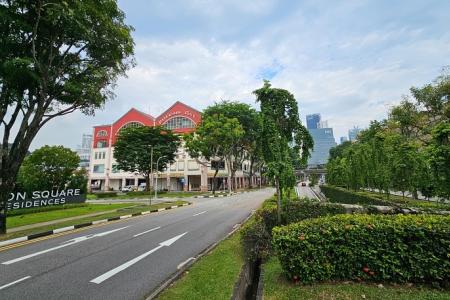
A portion of Merchant Road near Riverside Point and Magazine Road will soon be converted for pedestrian use to create a continuous walking route between Fort Canning Park and Pearl’s Hill City Park.
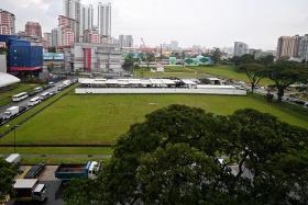
The pedestrianisation will be carried out by property firm City Developments Limited (CDL) as part of its ongoing redevelopment of the former Central Mall and Central Square.
Both these developments were demolished earlier in 2024. The Urban Redevelopment Authority (URA) has given CDL the go-ahead to build Union Square at the site – a mixed-use development with offices, shops and homes that will sit between Merchant and Havelock roads.
Union Square, which will also have two conservation buildings and a new three-storey hotel block, is set to be completed in 2029.
A URA spokesperson said the partial pedestrianisation of Merchant Road is one of the key features of Union Square that will benefit the public.
Plans for the pedestrianisation works were raised as a possibility by URA in as early as 2019, when the agency unveiled its Draft Master Plan, and were confirmed in a recent exhibition of the agency’s upcoming Recreation Master Plan.
The URA Master Plan is a statutory document that guides Singapore’s development for the next 10 to 15 years, with the next updated edition due to be exhibited in 2025.
The development of Union Square is being carried out under URA’s Strategic Development Incentive Scheme, which encourages the redevelopment of older buildings in areas such as Orchard Road, the Central Business District and Marina Centre.
Developers are offered incentives such as increased floor area in their new developments.
A CDL spokesperson said on Sept 25 that Union Square will have a total gross floor area of about 735,500 sq ft, which is about 67 per cent greater than the floor area of the developments it will replace.
The new development will include plazas and public spaces, as well as the partial pedestrianisation of Solomon Street to improve connectivity between Fort Canning and Pearl’s Hill, the spokesperson added.
Pearl’s Hill is the site of a new housing estate – with some 6,000 new homes, including public flats – that will be built over the next decade.
In the future, pedestrians will be able to walk for about 1km to get from one hill to the other.
This route will go through CanningHill Piers – an upcoming mixed-use development on the site of the former Liang Court slated to be completed in 2025 – across the conserved Ord Bridge, and through Union Square and the Chin Swee public housing estate.
Other improvements CDL will carry out include refurbishing the existing pedestrian overhead bridge in Upper Cross Street and adding sheltered walkways linking Union Square to neighbouring sites.
Heritage markers will also be installed in the development, the spokesperson for CDL said.
Mr Ho Yong Min, an urban design and heritage educator who runs The Urbanist Singapore Instagram and TikTok accounts, said the plans for Merchant Road reflect a growing recognition of prioritising walking and the needs of pedestrians in urban planning.
He suggested incorporating structures to provide shade, artworks, signage, rest areas and water refill stations into the route to make it more user-friendly.
Pointing to the Southern Ridges – a network of green spaces that links four parks in Singapore’s south and has created new paths in areas that were previously inaccessible – Mr Ho said the “hill to hill” link between Fort Canning and Pearl’s Hill has the potential to become a popular pathway, as it “invites residents to explore the city in fresh ways”.
Get The New Paper on your phone with the free TNP app. Download from the Apple App Store or Google Play Store now


